In an aerial video from September, waves of seawater crash over the coastal railroad in San Clemente that connects Los Angeles and San Diego – a storm surge that ended up causing so much damage that Metrolink and Amtrak had to discontinue rail service in September and October while the tracks were repaired.
Up the coast at Capistrano Beach, an aerial video from August shows a parking lot-turned-pool where boulders piled up to shield the pavement are overcome by the onrushing ocean. Waves break against seawalls and spew mist into the air as water laps across the decks, porches and walkways of nearby homes.
In both videos, the beach is nowhere to be seen. It’s a problem playing out all along the 1,000-plus miles of California coastline that are visited by millions of people every year.
Sea level rise isn’t some far-off concern. For coastal Orange County and many other low-lying areas around the globe, it’s here today.
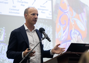
Meet the Expert: Brett Sanders, professor of civil and environmental engineering
“We all have a responsibility to be stewards of the earth and the resources it affords humanity. Work is critically needed now to provide for future generations."
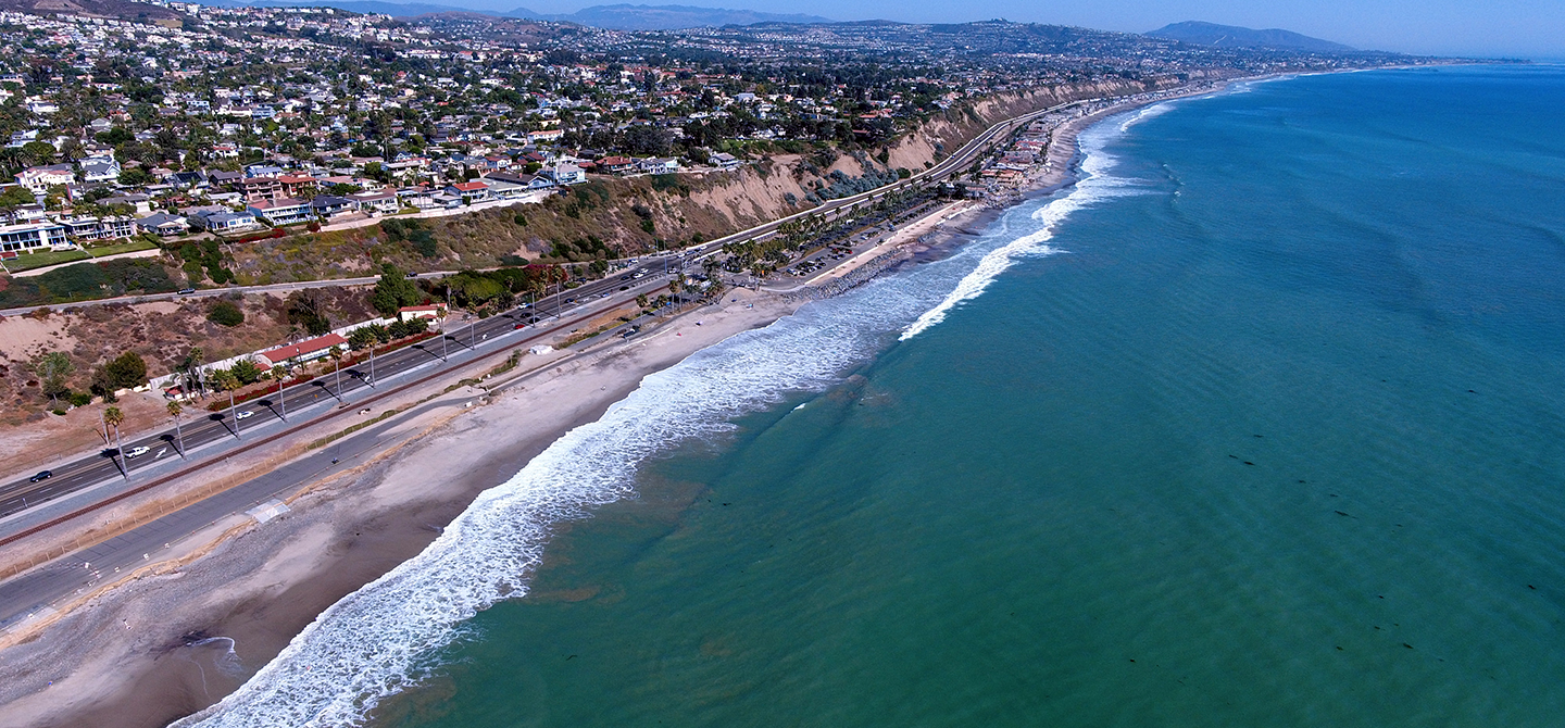
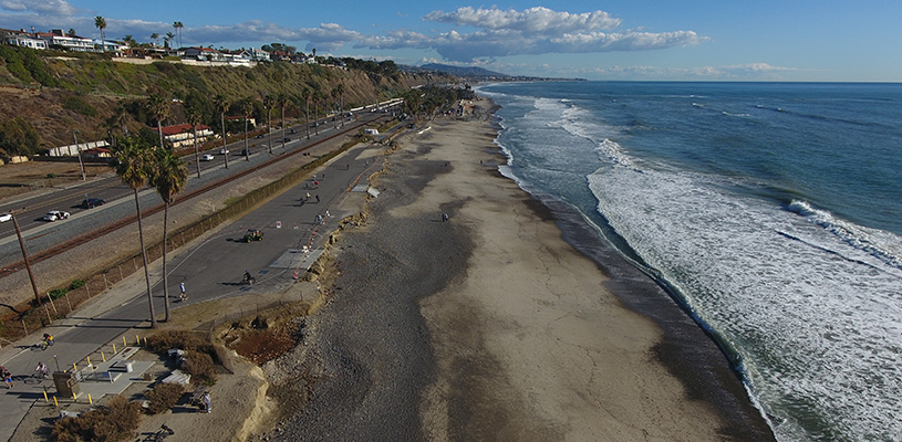
The natural protection provided by beaches that would have held back waves has thinned. There are multiple reasons for this, and sea level rise caused by climate change – which will only worsen in the future – is one of them.
Aside from its coastline, California has two regions that are especially at risk for flooding, says Brett Sanders, a UCI professor of civil and environmental engineering.
The Bay Delta region, where the Sacramento and San Joaquin rivers flow into San Francisco Bay, is a linchpin in the state’s water system. Rising saltwater levels could contaminate the freshwater supply, while human development protected by levees could be swamped.
In the south, the coastal plain stretching from Los Angeles through much of Orange County could also suffer severe disaster. More than 10 million people live in the area, which is bordered by steep mountains capable of producing rapid runoff from sustained rainfall. The region’s channelized rivers used to shift course across the coastal plain during major storms – and gushing water could do that again if there’s heavy precipitation in a short time.
“We don’t know where the Los Angeles River, for example, is going to break, cutting a new path from downtown L.A. to the coast. It’s just going to be a mess,” Sanders says. “Climate change is warming the atmosphere, so it holds more moisture, which will make these rainstorms more intense when they do happen.”
At the same time, much of the development in Southern California took place during the 1950s, ’60s and ’70s, when the Pacific decadal oscillation – a multiyear climate pattern – was in a cool phase and wave energy and storm surges were less severe. Homes, hotels, roads and railways were built right along the coast.
“Climate change is warming the atmosphere, so it holds more moisture, which will make these rainstorms more intense when they do happen.” - Brett Sanders
That calm era is over. Some data suggest that climate change will also cause south swells to grow stronger, which would make storm surges stronger.
While the sea eats away at the coastline, dams and stormwater infrastructure across California block sediment from replenishing beaches that normally help fend off those storm surges. In addition, concrete armoring prevents crumbling cliffs from collapsing onto beaches, adding sand and sediment.
“The beaches are slowly starving,” Sanders says. “We don’t have as wide and strong of beach sand as you would like to have to defend against coastal erosion.”
Golden State seashores protect fragile wetland ecosystems and are enjoyed by millions of people every year who arrive from communities across the state and country – and around the globe. In fact, coastal tourism and recreation in California account for $26 billion in annual economic activity.
Beach nourishment – the practice of hauling in sand and sediment – is possible and, in fact, was undertaken as early as the 1930s in Southern California to make the wide, sandy beaches that lured droves of visitors and created a tourism economy. Today, sediment from flood control channels can be placed on the beach, as is done in Newport Beach, or it can be pumped in from just offshore.
Another solution is to establish vegetated dunes, which actually grow vertically by capturing sediment carried by the wind – providing a buffer from the sea.
“If we could make space for dunes and supply sediment, we could have dunes that rise faster than the sea level,” Sanders says. “But we would need to avoid walking over every bit of beach and rely more on boardwalks so the plants could grow. Public participation is crucial for this to work.”
In some places, people will have to retreat from rising seas. One idea is for the state to buy out coastal property owners and then rent the property back to them as long as it’s livable. That way, property owners could cash out their investments, and the state could abandon the property when it becomes sensible.
“In most places, only a small subset of stakeholders have access to projections about flooding and the ability to measure the costs and benefits of proposed solutions. We want to make those tools accessible to everyone.” - Brett Sanders
But to make these choices, the public and policymakers need information about projected flood risks. That’s exactly what Sanders and his team produce. Their models and simulations of future flooding incorporate detailed data about ocean levels, rainfall, streamflow, topography and land cover – whether it’s asphalt, buildings, vegetation or something else. These easy-to-grasp visualizations help planners and policymakers prepare to mitigate flooding by revealing what floods might damage and destroy.
Sanders has found that these types of models increase engagement among residents, activists, public works officials, emergency management responders and urban planners. Since this comprehensive, dynamic information about flooding can be understood by anyone, it can help move the needle on solving the problem.
“We live in a world where flooding is complicated,” Sanders says. “In most places, only a small subset of stakeholders have access to projections about flooding and the ability to measure the costs and benefits of proposed solutions. We want to make those tools accessible to everyone.”
– Aaron Orlowski, UCI